Route A: From South West
Scroll down for Route B The Miners’ Track
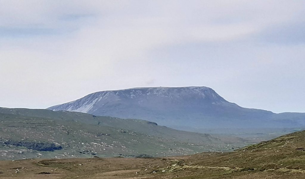
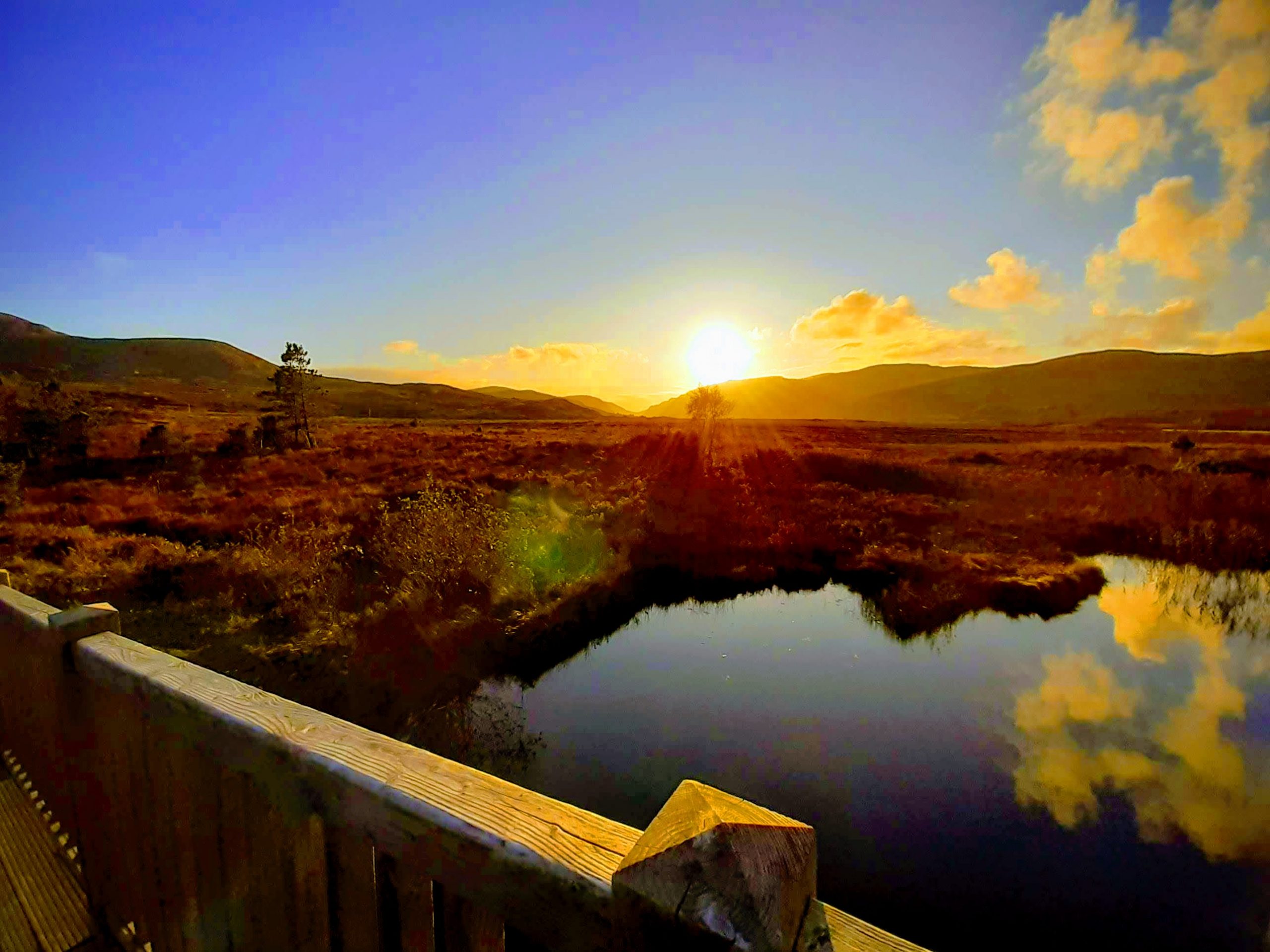
Of the “Big Two” climbs in Donegal I personally enjoy Muckish a little more than the more popular Earagail. The route is not as crowded, particularly at weekends, the ascent described here is softer with no scree to contend with, and the views are just as good from the summit plateau.
Just to be clear, there are two main routes up Muckish. The northern approach (B) using the old miners path is tricky and challenging. It is outlined later on, but for those looking to climb the mountain without too much hassle this ascent is much more straightforward.
From Kilmacrennan, follow the signs for Glenveagh National Park. When you come to the park entrance continue on R251 for about 2.5 km then turn right on R256 and continue to Muckish Gap. Look for a roadside shrine and then park at the small car park some 100m past it on the left.
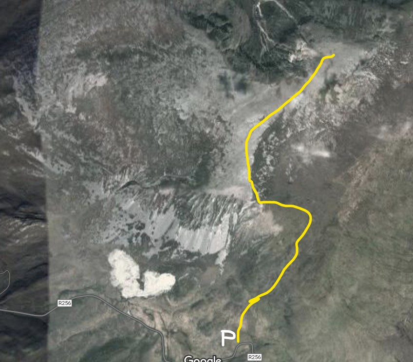
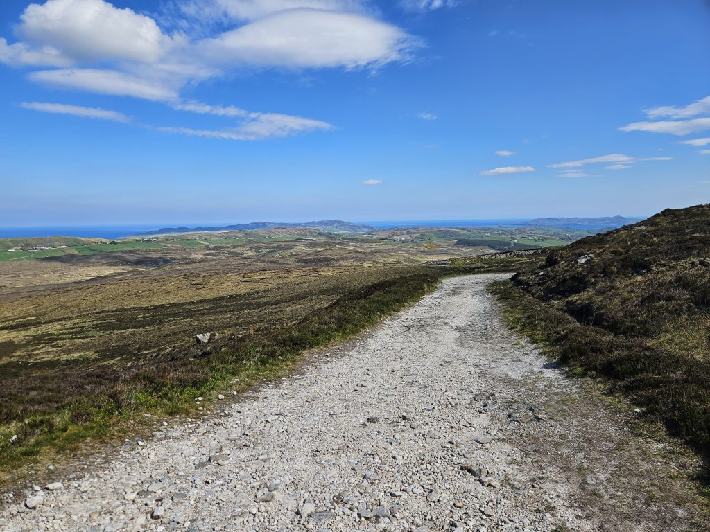
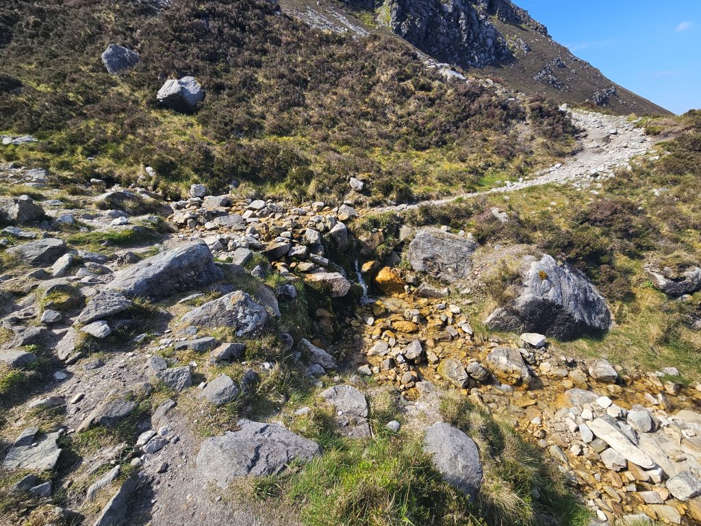
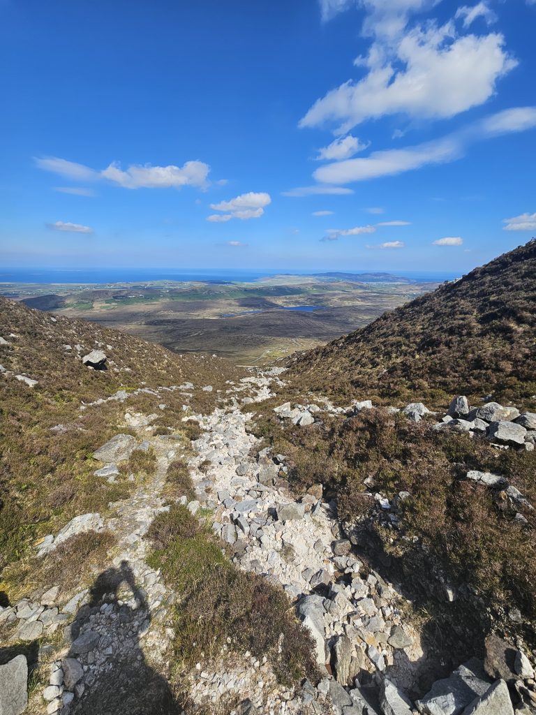
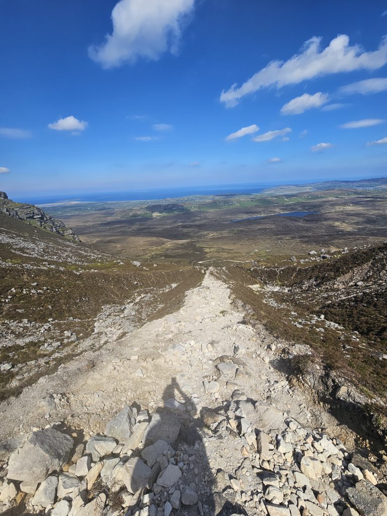
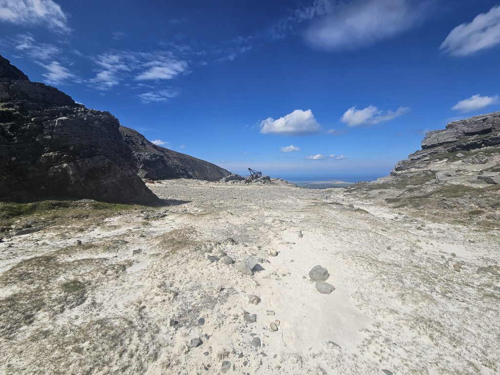
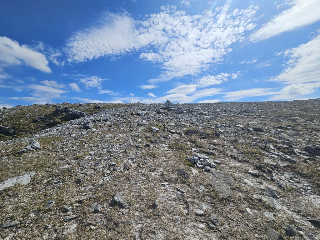
From the parking spot, cross some boggy ground after which a short climb takes you towards an obvious gap leads to a clear track. Follow this track which climbs very gently around the mountain and after a short walk, first the cross on the Northern edge of the summit will come into sight followed by the cairn to the southern end of the summit. At this point, you need to pick up a path to the left that leads up the steep slope of the mountain. Keep climbing steadily and you will reach a rocky path just below the plateau. Follow this to gain the rocky, expansive plateau and then pick your way toward the obvious massive cairn.
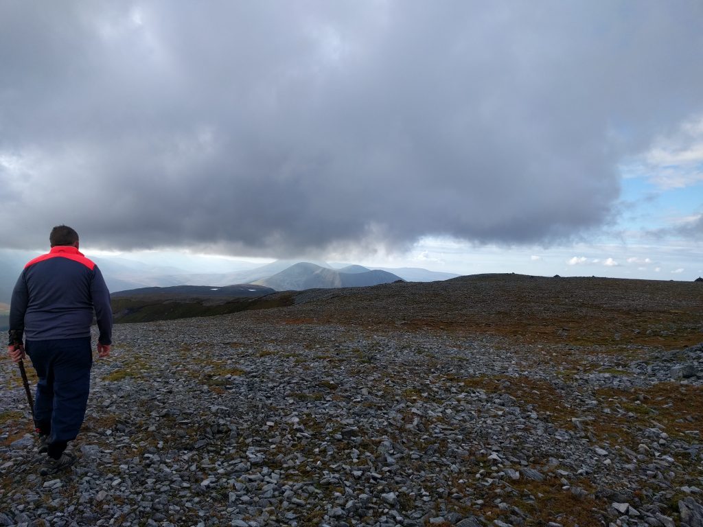
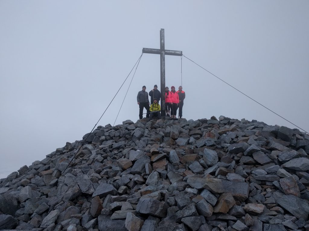
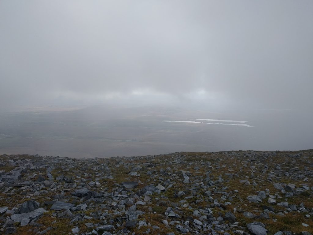
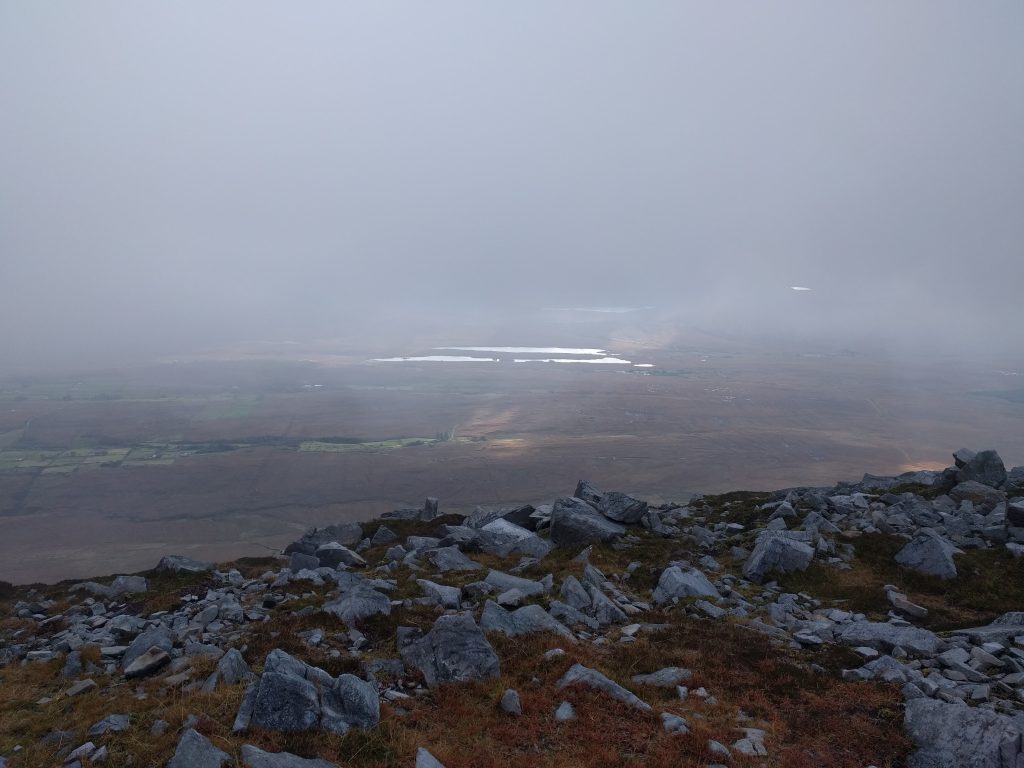
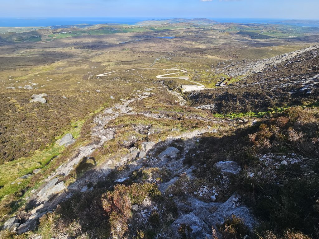
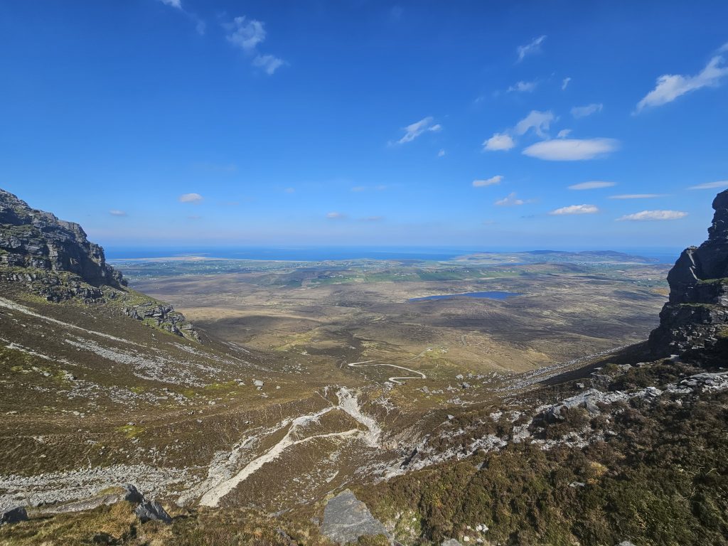
There is a trig pillar just beyond this and it is definitely worth walking further to the north end of the plateau where there is a large cross atop a cairn, and superb views to the north coast. On the return leg the important thing is to find the rocky path on the south west side of the plateau. From here it should be plain sailing downhill to the starting point with nice views of Muckish Gap and the well known “Droichead na nDeor” in the distance.
- Trailhead: Near roadside shrine at Muckish Gap R256
- Facilities: Small roadside car park. No Toilets.
- Time: 1-1.5 hours to summit plateau depending on pace.
- Ascent: 666m approx.
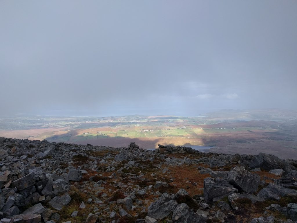
Note: As with all mountain routes I would advise that this climb be undertaken only on a good clear day with little wind. Even with the paths to the summit mist and high wind will make navigation difficult and dangerous, plus the main attraction of Muckish is the beautiful views!
Route B: The Miners’ Track

For many hillwalkers this is the preferred route up Muckish Mountain. It is certainly a tougher climb and in places the path has steep drops to the side. While there is nothing in the route that would induce vertigo it demands concentration and careful attention to navigation as there are dangerous cul de sacs and the route is subject to weathering. Having said this, climbing the Miners’ Track is up there with Sliabh Liag as one of the most exhilarating and rewarding climbs in the county, if not the country.
To get to the trailhead directions are largely the same as for route 12 and 13. Follow the N56 north of Creeslough village to take a left turn just before a graveyard (RHS of the road). Follow the minor road straight ahead, passing Muckish Sand and Gravel quarry and then past the new Railway Walks car park and through a gateway. Continue for about 600m past the older car parking area and then uphill on the narrow paved road until you come to the small parking area where the road peters out to a gravel track. Park here (It may be busy at weekends) and off you go. At this point I should remind you that this is a serious climb and hiking boots, walking poles and a well stocked rucksack are essential items.
Note: This climb is hazardous and inadvisable in bad weather with poor visibilty.
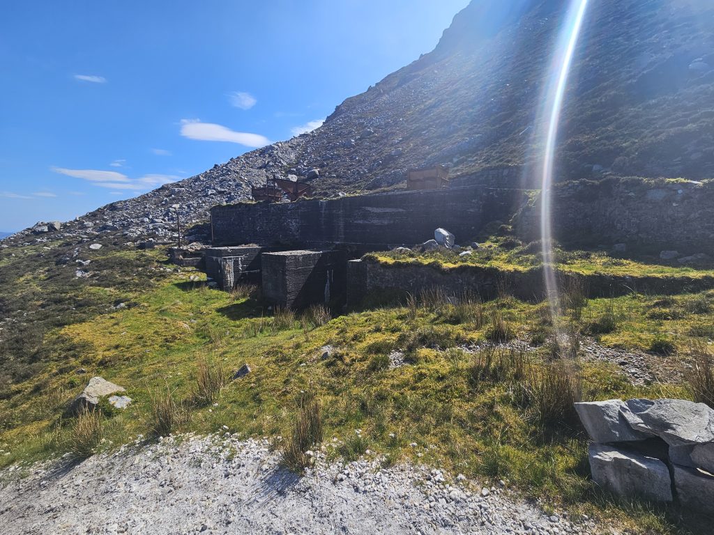
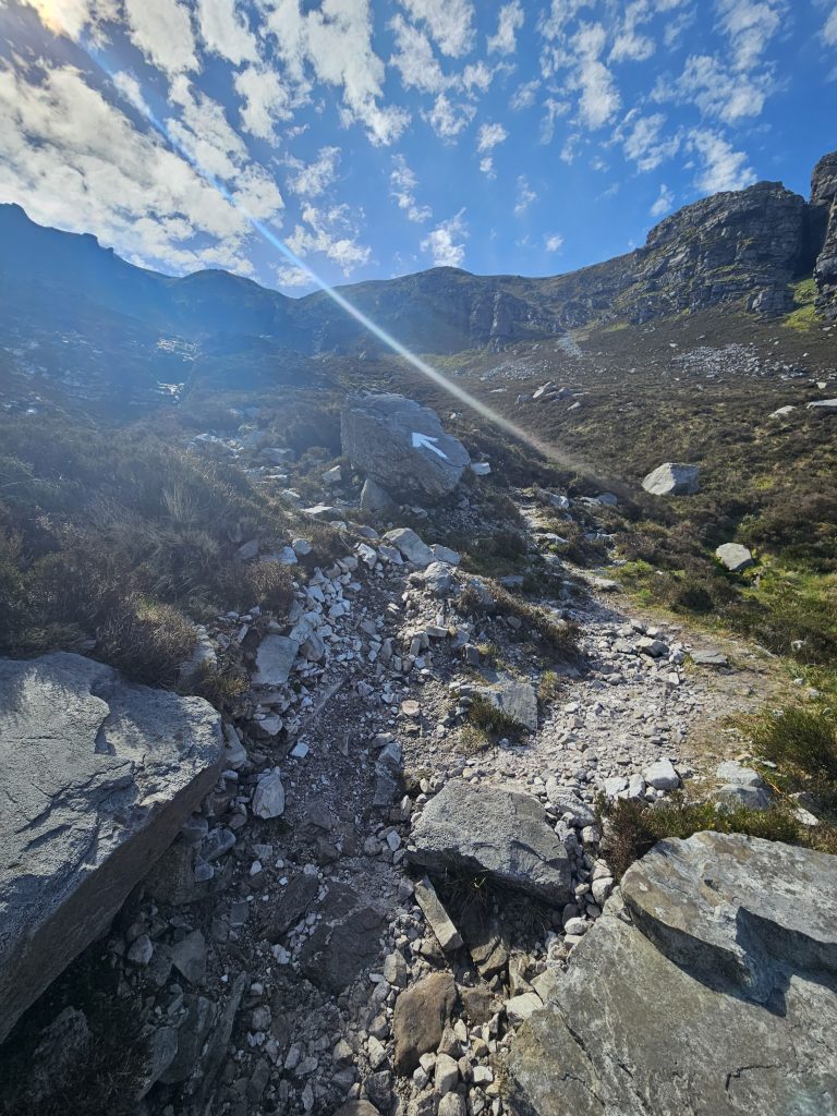
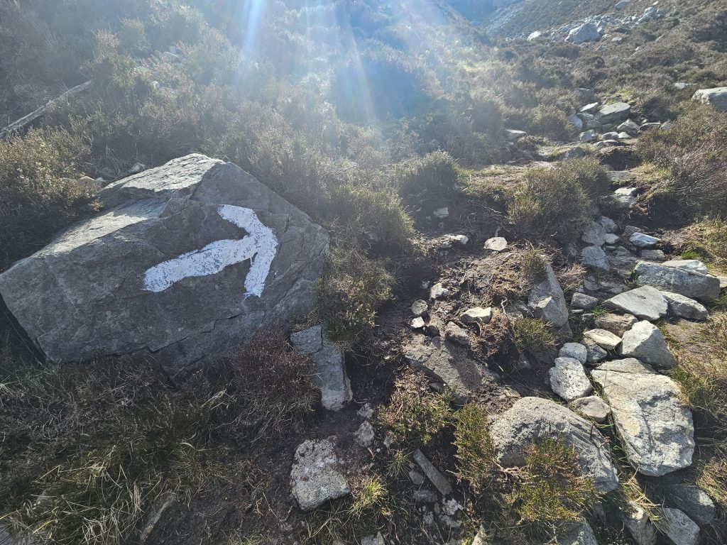
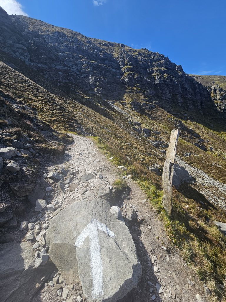
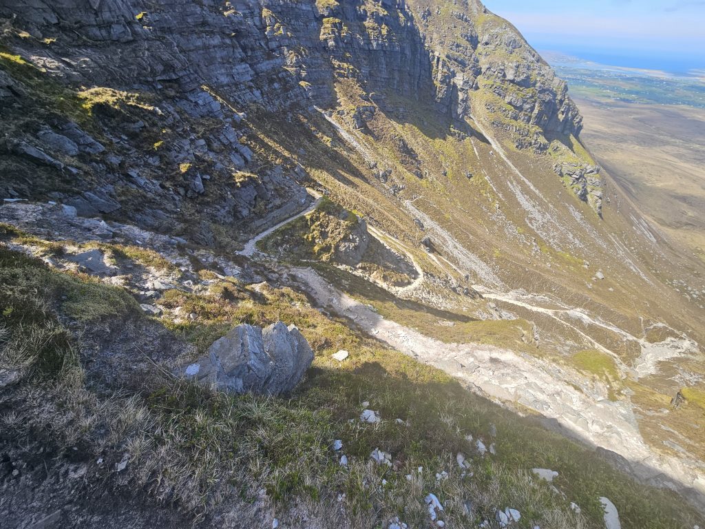
Walk up the gravel track until you see the old sand loading bays on your left. Turn to the right now and on a low wall you should see the first of a number of helpful white marker arrows that have been painted on various rocks to show the way. Walk past the arrow and cross a narrow stream to pick up the start of The Miners’ Track.
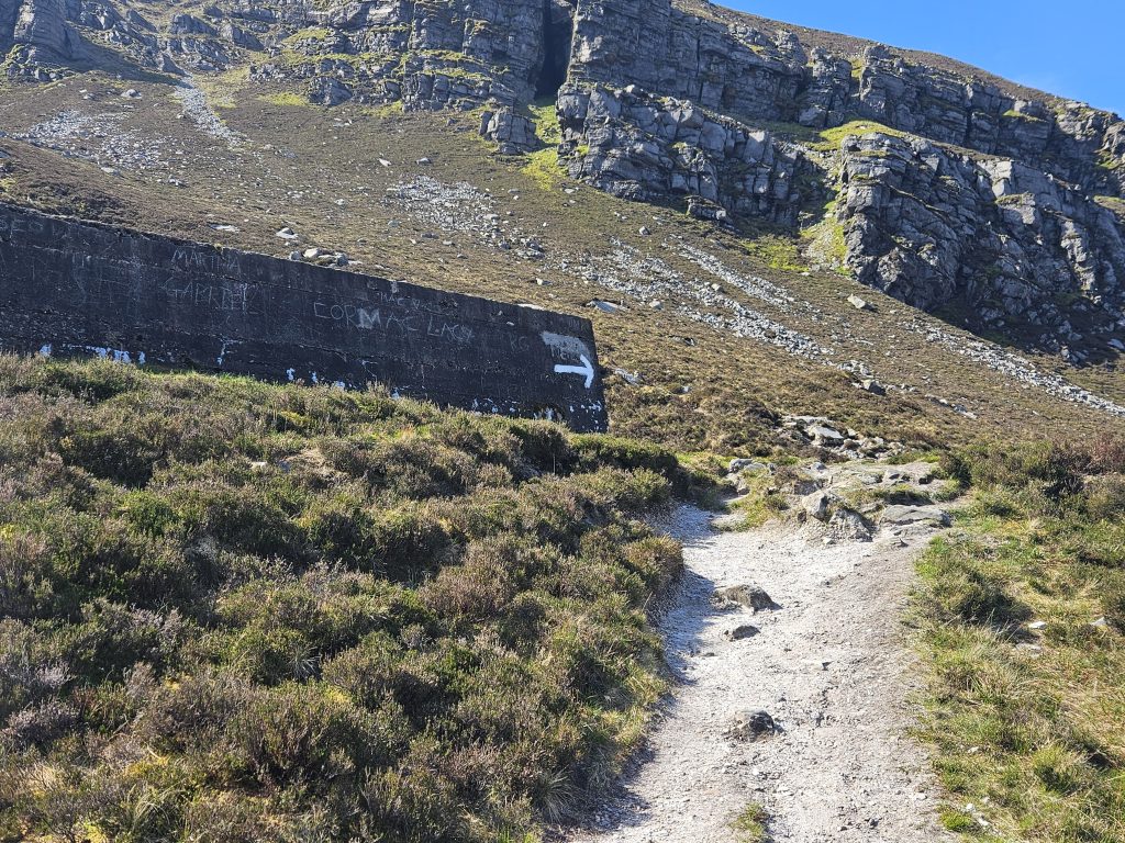
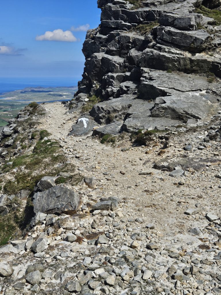
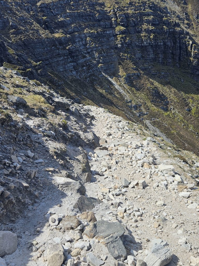
From now on it is most important to keep to the track as you climb up through the cliffs. There are a number of places where you can take a wrong turn and if in any doubt stop and calmly scan the area in front for the next arrow waymark. You will come to a rocky gulley where you need to stay on the left side if possible. At the top of this gulley there is a clearly visible arrow that will set you on the miners’ path again if you have deviated off. From here you continue on a path that consists of rough hewn steps and some trodden earth which winds its way over and back as you climb. Pay attention to your footing at all times but don’t forget to enjoy the climb at the same time. Presently, you will round a corner and see two rusted mine shafts on the steep hillside. The good news is that you are almost up at the quarry.
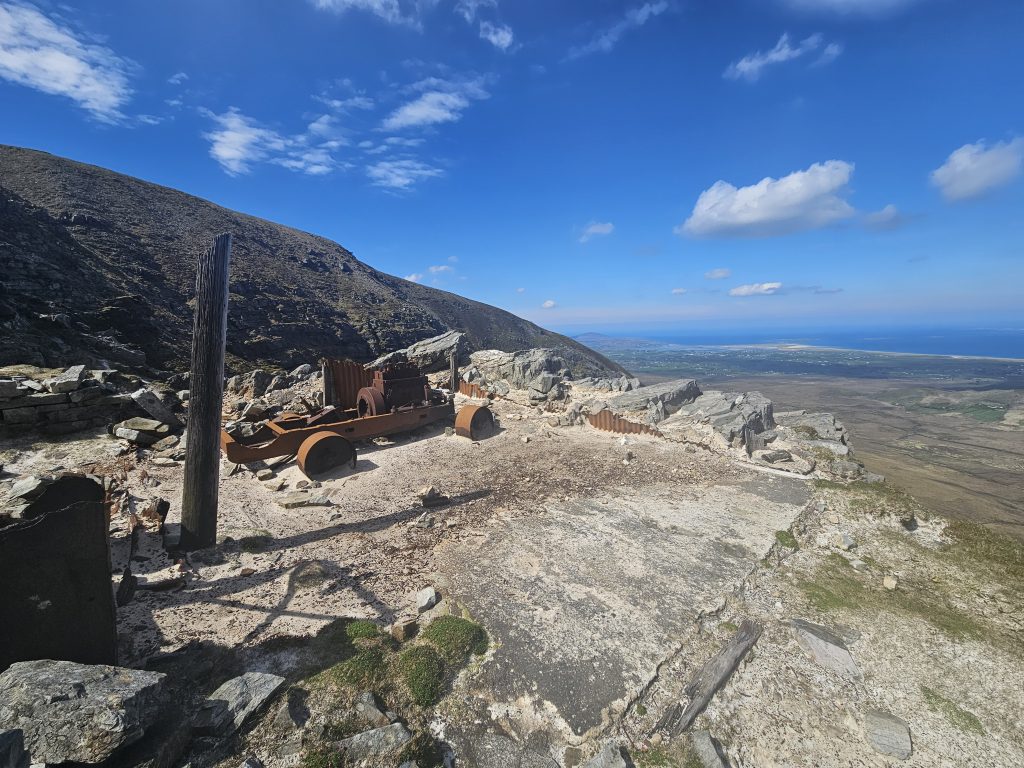
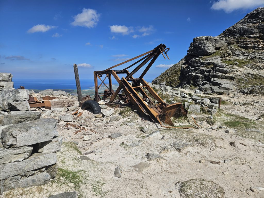
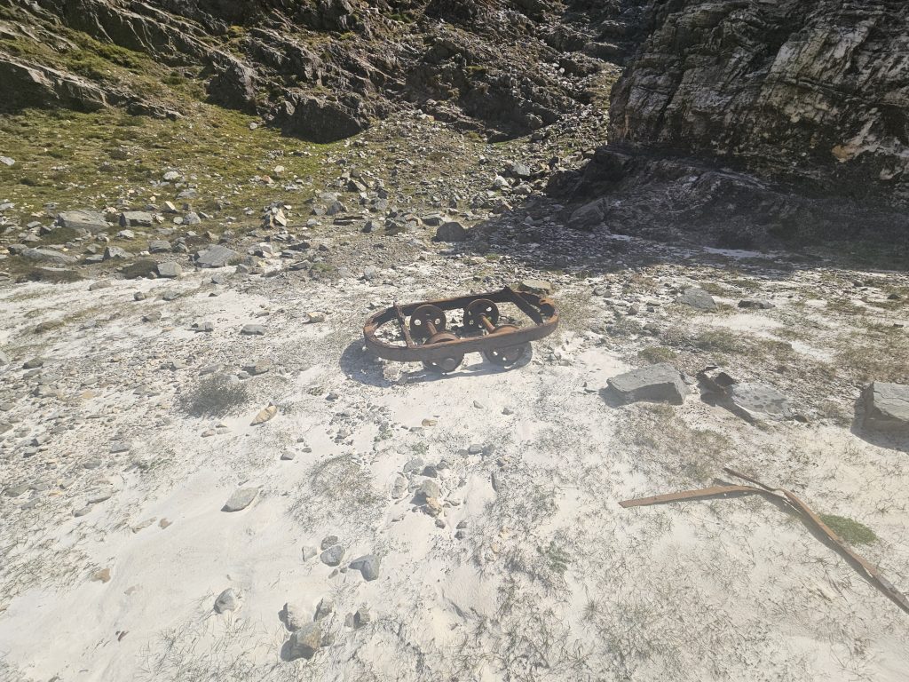
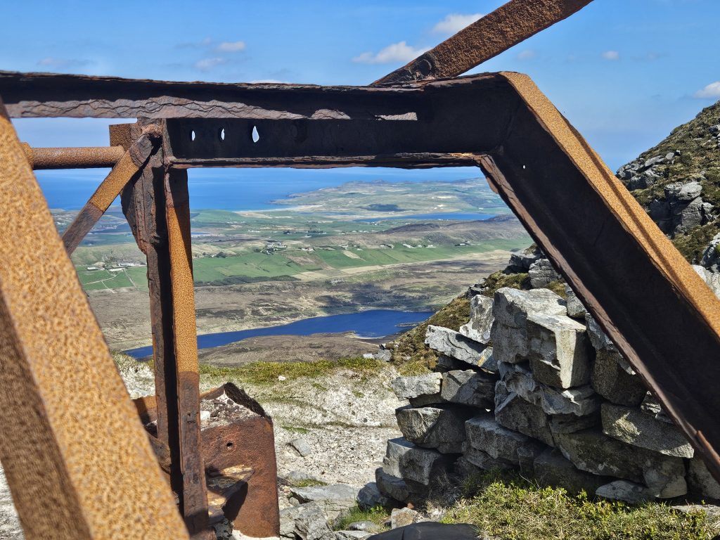
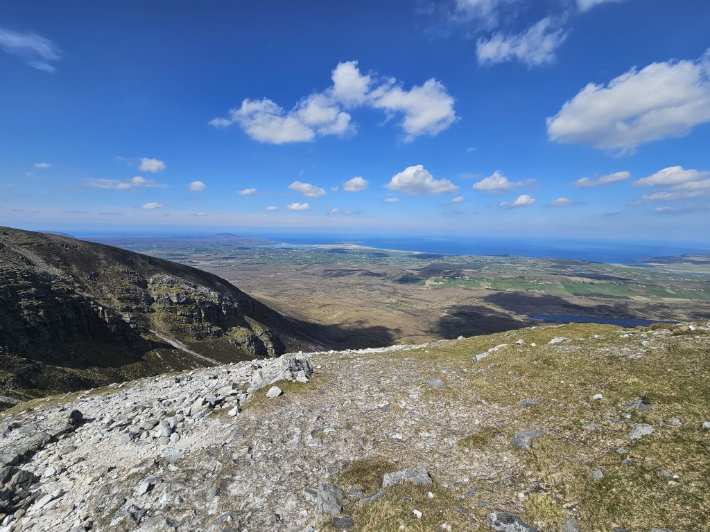
The old quartzite mining quarry is hard to miss. You cross a sandy gulley and round a corner into a large flat amphitheatre with steep rocky sides at the back. The quarry is a place of some awe. It is hard to imagine men climbing the path to toil here up to 1955, extracting quartzite from sand that was mainly used in lenses for spectacles. It is quiet today except for the cawing of an odd raven overhead. Take a short while to marvel at the crumbling buildings and old rusting machines, and also to drink in the fabulous views to the north coastline and Tory Island in the distance.
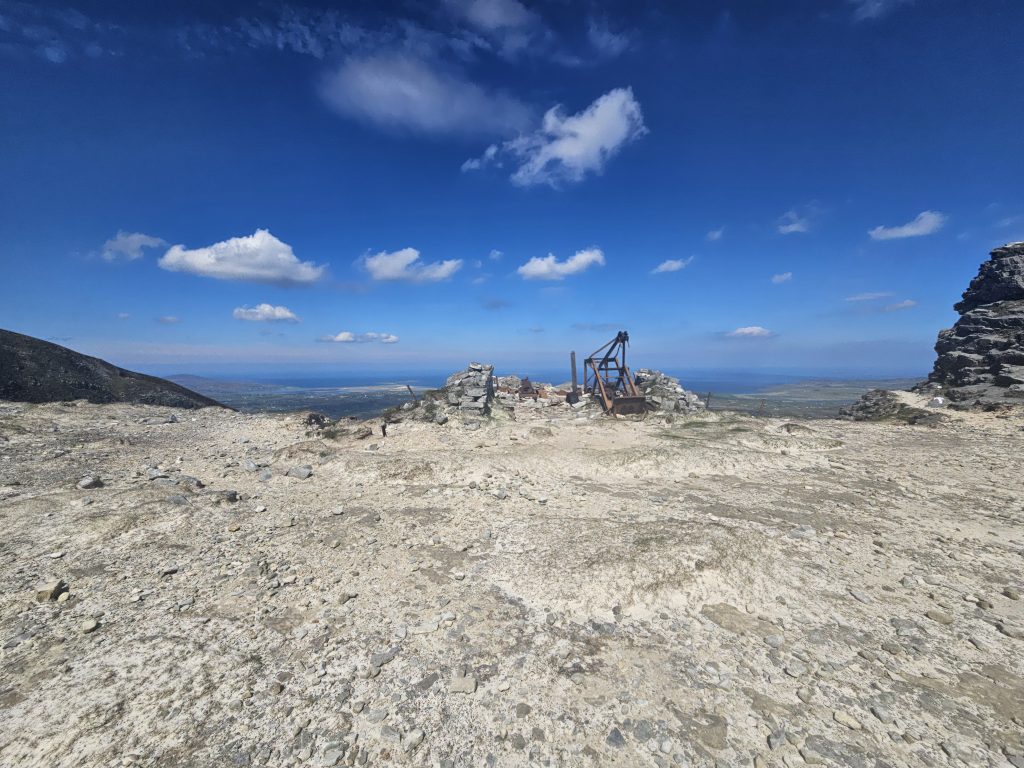
You are not far from the summit plateau now. Walk to the right side of the quarry as you face north and you will see a white painted arrow that leads you on to a stone path. This winds it’s way on upwards. a bit of care is needed just after the quarry where there is a steep drop to the left but otherwise it is now plain sailing. in the end the path disappears but you are now up at the plateau and you should see the Muckish summit trig pillar ahead and to the left. Take time to explore the plateau with its huge cairn to the south and iron cross on the north east side.
A couple of options now. You will probably choose to descend back to your car by retracing your steps (Carefully!!) down the miners’ path again, or, if you have a friendly taxi service (Herself, not a climber!) you could traverse the mountain to the south west side and pick up the path from Option A to descend to the car park at Muckish gap.
- Trailhead: Miners’ Path car park 1 km beyond Foot of Muckish trailhead.
- Facilities: Small parking area. Remote. No Toilets.
- Time: 1.5 – 2 hours to summit plateau depending on pace.
- Ascent: 666m approx.