The map below shows the approximate location of the walks on this website. They are listed below and are coded as E (easy), M (Moderate) and H (Hill Walk)
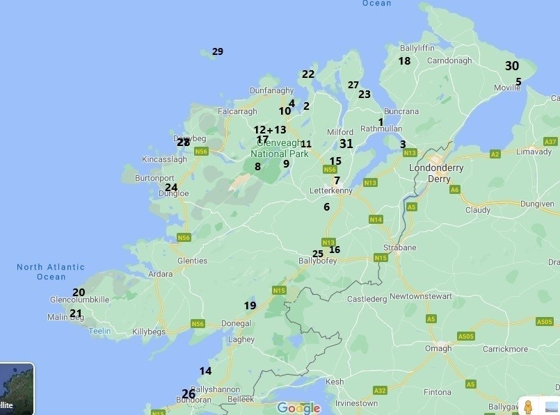
| 1. Rathmullan Beach E | 2. Trá Mór Boardwalk E |
| 3. Inch Reserve E | 4. Ards Forest Park E |
| 5. Moville Shore E | 6. Corravaddy Wood E |
| 7. Carn Hill / Knockybrin M | 8. Glenveagh Bridle Path M |
| 9. Glenveagh L. Insagh M | 10 Ards Outer Loop M |
| 11. Glenveagh Lake Walk E | 12. Old Railway Loops E |
| 13. Old Burtonport Railway M | 14 Rossnowlagh E |
| 15. Ballyarr Wood E | 16. The Steeple M |
| 17. Muckish H | 18. Butler’s Glen H |
| 19 Bluestacks L. Belshade H | 20. Glencolmcille Loops H |
| 21. Sl. Liag Pilgrim’s Path H | 22. Melmore Head H |
| 23. Knockalla Ridge H | 24. Burtonport Rail trail E |
| 25. Drumboe Wood E | 26. Rougey Cliff Walk E |
| 27. Portsalon Loop M | 28. Gola Island E |
| 29. Tory island M | 30. Inishowen Head M |
| 31. Milford Colmcille Trail E |